
Finding Town of East Hampton Streets
An East Hampton street directory search works best as an address-to-parcel trail. Normalize the house number, street name, directional, suffix, hamlet, municipality, ZIP code, and tax-map identifier before comparing records. The Town’s eGov portal, map layers, and the County Clerk each use a different portion of that information. A result becomes more reliable when the address, parcel, jurisdiction, and record date point to the same property.
Property ownership and a recorded instrument are not the same as a statement about every person connected with an address. Keep each record’s label intact. A parcel page may display an assessed owner; a deed names a grantor and grantee; a mortgage can name a mortgagee or mortgagor. Those are legal roles. The street directory should preserve the role, date, and source without adding conclusions not shown in the record.
- Enter the address in Town eGov using the local House No and Street format, then select only the matching parcel.
- Save the tax-map identifier and confirm the Town, Village, Sag Harbor, or Southampton jurisdiction on the map.
- Use Town GIS Identify or Query to inspect the subject parcel and the parcels immediately around it.
- Run the same address or tax-map information through the Suffolk County Clerk tax-map and land-record routes.
- For a past street question, pair the recorded trail with dated maps, assessment material, newspapers, or archive sources.
Note: Each East Hampton street result needs a source date, because property displays, map layers, and recorded instruments can update on different schedules.
Town of East Hampton Street Workflow
The official street workflow starts with the Town Assessor’s property framework. The Assessor maintains the annual assessment roll, ownership records, property inventory, tax-map district mapping, and the street-address database used for E-911. The Town Tax Receiver directs users to eGov for tax bills and receipts. More than 24,000 tax bills move through this system, so a tax entry needs its parcel context and date before it is used as an East Hampton street directory reference.
Parcel data solves a common street-search problem: a similar name can appear under a nearby postal place or across a municipal line. Search the property tool, identify the parcel on GIS, and then use the County Clerk record only after the tax-map number agrees. This reduces common-name and street-name mistakes. It also keeps a property result from being misread as a general list of people on the street.
- Parcel
- A tax-mapped unit of real property used to connect an address, map, and recorded land trail.
- Situs address
- The physical location of a property, which can differ from a mailing address.
- Plat or filed map
- A recorded map that can identify subdivision or parcel context around a street.
- Criss-cross directory
- A reverse address arrangement in a historical collection, useful only when the collection has been verified.
Town of East Hampton eGov Quirk
Town eGov’s search guidance has a local rule worth following. The Address route takes House No and Street. Enter the number and street name without the suffix, and use initial letters when helpful. Once eGov returns a candidate, preserve the full official address that the record displays. This small formatting difference can decide whether an East Hampton street directory address search finds the parcel at all.
The Tax Map Number route uses the SWIS code plus Section.Sub-Section-Block-Lot.Sub-Lot and suffix values from the tax bill. The guidance says zeros can be omitted and that the school-district code is not used. Bill Number is a third route. These distinct fields show why a street name alone is a weak cross-system key.
| Town eGov street route | Observed fields | Search tip | Next check |
|---|---|---|---|
| Address | House No; Street | Omit the street suffix | Confirm the candidate parcel |
| Tax Map Number | SWIS; section, sub-section, block, lot, sub-lot, suffix | Zeros may be omitted | Compare the recorded full value |
| Bill Number | Bill number | Use the number printed on the bill | Retain the bill or receipt date |
Town of East Hampton Parcel Layers
The Town GIS directory connects property-search tools, Town Maps, Suffolk County GIS, FEMA, USFWS, and state GIS resources. Its public ArcGIS service exposes parcel boundaries, land use, municipal and village boundaries, fire and school districts, historic districts, waterbodies, environmental zones, and other Town layers. Query, Find, Identify, and Export Map are available, with a maximum record or selection count of 2,000.
Begin with the subject parcel. Then identify adjacent polygons and record their tax-map identifiers, displayed addresses, map layer, and the direction of the relationship. A parcel across a road is across road, not contiguous. The GIS service includes an accuracy and currentness disclaimer and should not be treated as a legal survey or as proof derived from a screen pixel.
The Town public map service shows the parcel, boundary, district, land-use, and environmental layers used to ground an East Hampton street directory search.
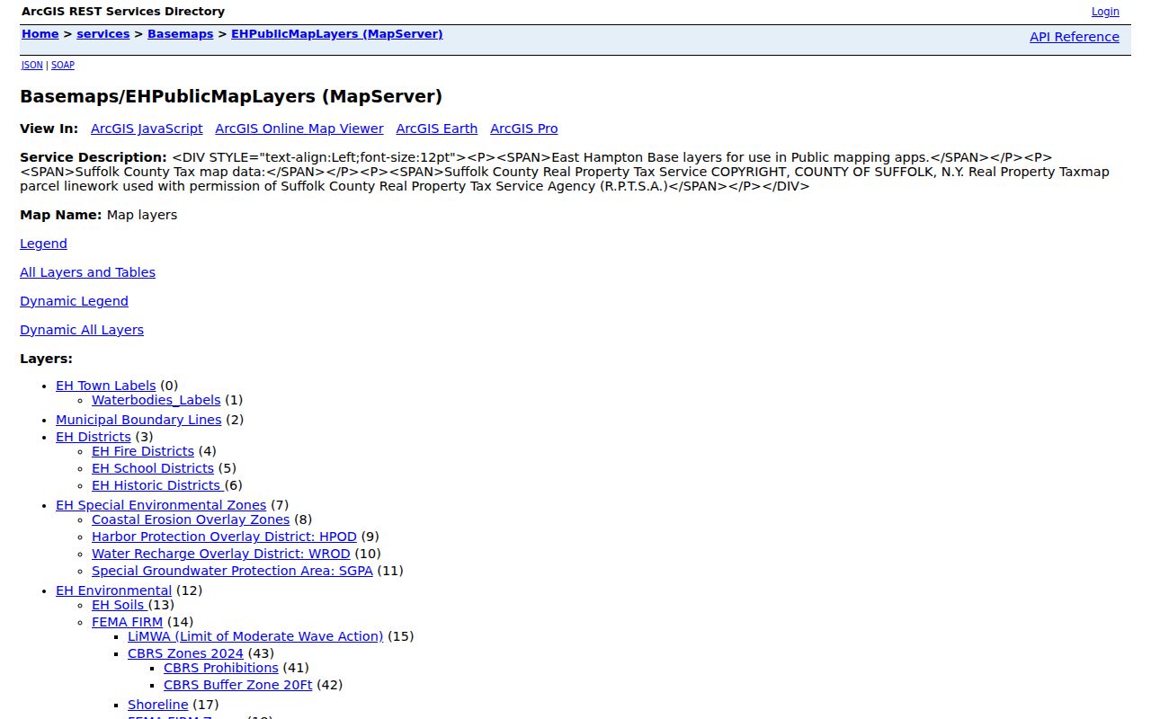
Map layers add geographic context to a street record. They do not turn map adjacency into a statement about personal relationships, shared household membership, or a legal boundary survey.
The Town’s property-search ArcGIS Experience is a second visual route for locating a property before comparing the official parcel and Clerk records.
Use the property-search display to guide the next official lookup, then preserve the tax-map ID and map date rather than relying on a visual match alone.
Note: The official map service documents Identify and Query, but the research did not verify a separate formal buffer or radius tool for East Hampton parcels.
Town of East Hampton Street Sources
An address can lead to several East Hampton record sets, but each one answers a narrow question. eGov helps find the parcel and tax-bill route. Town GIS establishes map context. Suffolk County Clerk searches add indexed land instruments, and county tax-map search can display the owner, address, district, section, block, and lot. Historic maps and newspapers can explain a past street or building, but they need their own dates and source conditions.
| Address-keyed source | What the East Hampton street record shows | Custodian | Access path |
|---|---|---|---|
| eGov property route | Parcel and tax-bill context | Town Assessor and Tax Receiver | Address, tax-map, or bill number |
| Town ArcGIS layers | Parcel, boundary, district, land-use, and water context | Town GIS | Find, Identify, Query, or map export |
| County tax-map lookup | Owner and address display, district, section, block, lot | Suffolk County Clerk | House number, street name, ZIP |
| Recorded land index | Grantor, grantee, document type, received date, notations | Suffolk County Clerk | Name, tax-map ID, address, date, liber, or page |
| Historic sources | Older address, building, owner, or public notice context | Library and archives | Maps, assessment rolls, newspapers, and yearbooks |
The street directory record chain is address to parcel, parcel to instrument, then instrument to dated historical context. It does not justify filling gaps with an assumed household description.
Town of East Hampton Deed Trail
The Suffolk County Clerk kiosk is the official land-instrument route for the Town of East Hampton. Land records have been recorded and imaged online from 1987 to the present. The main search offers tax-map address fields for House Number, Street Name, and ZIP, along with tax-map ID, name, date range, liber and page, index number, and map fields. Tax-map results are limited to the first 2,000 rows, so an exact parcel key is more useful than a broad street term.
For each recorded instrument, retain the document type, parties, received date, liber and page or document identifier, property description or tax map, and any notations. The Clerk’s results can identify a grantor, grantee, mortgagee, mortgagor, lien claimant, or other role. A newer deed can lag the alert system by eight to ten weeks, according to the County Clerk’s HOWL notice. Search the instrument directly when timing matters.
Older East Hampton street history needs a separate path. The Clerk’s stated online imaging boundary is 1987, so pre-1987 questions may require older deed books or indexes, filed maps, library sources, assessment rolls, or a direct Clerk inquiry. Certified copies and image access can have a separate payment process.
Town of East Hampton Boundary Checks
Street search errors often begin with a postal assumption. Official community-wide data associates 11930 with Amagansett, 11937 with East Hampton including some Village area, 11954 with Montauk, 11963 with Sag Harbor including parts of Southampton, and 11975 with Wainscott. Those associations are helpful research labels. They do not turn a ZIP into a municipal boundary.
Sag Harbor is the key comparison. Its 11963 ZIP crosses the Towns of East Hampton and Southampton, while Sag Harbor Village is separately incorporated. East Hampton Village also has its own municipal identity within the broader Town context. Use a Town map, village-boundary layer, and parcel record before assigning a street result to the Town of East Hampton.
For a ZIP-led question, the East Hampton ZIP code directory keeps the postal and municipal checks in one workflow. Once the correct ZIP is narrowed to a parcel, return to the street directory chain for the address-level record.
Town of East Hampton Street History
Historic street research needs sources built for a past date. The Library of Congress 1909 Sanborn sheets can show building footprints, uses, materials, and hazards. They help explain a historic place, not identify who lived there. The 1955 East Hampton Village property map can show owner names by block across 15 double-page sheets, but it covers only the incorporated Village and supplies no master index.
East Hampton Library’s Long Island Collection holds deeds, wills, genealogies, newspapers, maps, diaries, photographs, and oral histories. The digital newspaper and yearbook archive starts in 1881. Pair an old map or notice with its year, page or image, map sheet, street form, and jurisdiction. That makes a historical street result traceable even when today’s address system differs.
Modern parcel records and historic collections answer different parts of the question. The East Hampton city directory route is the right place for the library and archive shelf, while a current street search should stay tied to the parcel and dated land record.
Town of East Hampton Street Terms
Street records become clearer when the field names are kept separate. The assessor’s street database supports address maintenance. The GIS parcel layer supplies a geographic outline. The tax-map identifier is the cross-system property key. A deed is a recorded instrument with named legal roles and an effective record date. These elements can agree, but one does not replace another.
Town maps also include school, fire or protection, water, lighting, road, and other special-district layers. Those layers explain service geography. They are not evidence that a person belongs to a household, a civic group, or a particular parcel. Record only the layer title and date when district context is relevant to a street question.
| Address | Street location used to begin a search |
|---|---|
| Tax-map ID | Property identifier used to link parcel and land-record routes |
| Map layer | Named visual data source and its date or currentness notice |
| Recorded role | Exact legal label such as grantor, grantee, mortgagee, or lien claimant |
Town of East Hampton Street Limits
An East Hampton street directory can show a parcel trail, public property context, and recorded roles. It cannot safely infer every person associated with an address. The research found no official public neighborhood-association or HOA roster, and the Town’s Citizens Advisory Committee pages are civic participation material, not a neighborhood census. A name in a meeting agenda should be cited only as the dated public role the document shows.
New York limits several categories that may appear near an address search. Address Confidentiality Program participants use substitute mailing addresses; physical addresses must not be reconstructed. Court matters can be sealed or otherwise omitted. Vital records have eligibility rules, and voter information is person-specific and purpose-limited. A missing online result can reflect a restriction, coverage gap, spelling issue, or wrong jurisdiction.
Note: The clearest street record states its source, map or instrument date, tax-map identifier, geographic relation, and any uncertainty that remains.